


Metar-Taf is a comprehensive weather application designed specifically for aviation enthusiasts and professionals. The app provides visualized METAR and TAF weather information for airports worldwide, presenting data in easy-to-understand, colorful metrics. With features like crosswind calculations, flight rules categorization (VFR, MVFR, IFR, LIFR), and text-to-speech functionality, users can efficiently decode and listen to METAR reports while multitasking.
In addition to its robust METAR capabilities, Metar-Taf offers detailed TAF breakdowns displayed hourly in tables, complete with sunrise/sunset times and temperature extremes. Users can track their favorite stations, access observations near their location, and search airports by ICAO code or name. The app also includes historical weather trend graphs, customizable units for various measurements, and automatic data saving for offline use. Available in six languages, Metar-Taf is an essential tool for anyone needing accurate, real-time aviation weather information.
Metar-Taf stands out with its extensive feature set tailored for aviation weather tracking. The app's METAR visualization presents significant weather and cloud information using intuitive symbols similar to non-aviation weather reports. Its unique crosswind calculation combines METAR data with runway information, providing pilots with crucial takeoff and landing insights. The TAF section breaks down forecasts hour by hour, displaying them in clear tables alongside sunrise/sunset times and temperature variations.
The app's tracking capabilities allow users to maintain a list of favorite stations for quick reference, find stations through an interactive map, and search airports by various identifiers. Historical weather data is presented through detailed graphs showing temperature, visibility, wind speed, and QNH trends. Metar-Taf's customization options are particularly impressive, offering adjustable units for speed, altitude, visibility, temperature, and air pressure across both metric and imperial systems. All airport times are automatically converted to local time, and sunrise/sunset calculations are based on precise latitude/longitude coordinates.
Accurate weather forecasting is essential for aviation safety and planning. Metar-Taf provides visualized METAR and TAF weather information for airports worldwide, ensuring pilots have reliable data at their fingertips.
The application breaks down complex meteorological reports into easy-to-understand metrics with colorful visuals. It includes significant weather symbols and cloud representations akin to non-aviation weather reports, enhancing comprehension.
Crosswind calculations are performed by combining METAR data with runway specifics, offering precise flight rule categorizations such as VFR, MVFR, IFR, LIFR. This empowers aviators to make informed decisions based on current conditions.
Additionally, the app features text-to-speech functionality that reads out decoded METARs, allowing users to multitask while staying updated on critical weather updates.
For comprehensive aviation planning, having a detailed temporal and spatial forecast range is crucial. Metar-Taf excels in this area by providing hourly breakdowns of TAF forecasts displayed in an organized table format.
Pilots can view sunrise and sunset times alongside minimum and maximum temperature predictions, which aids in strategic flight preparations. The app also tracks weather trends through graphs showing changes in temperature, visibility, wind speed, and QNH over today and yesterday.
Users benefit from historical METAR data covering recent hours, accessible directly within the app or via links to more extensive datasets online. This feature supports thorough pre-flight assessments.
Furthermore, airport-specific details such as runway directions, elevation, and location enrich the user's contextual understanding. When an airport lacks reporting capabilities, the nearest stationu2019s data is utilized for accurate calculations.
Comprehensive weather data
Customizable measurement units
Offline functionality
Multilingual support
Real-time aviation insights
Complex interface for beginners
Occasional data delays
Limited free features
Highly specialized niche
Requires regular updates

Live local weather updates: various widgets & radar maps & hourly forecast.
 4.70
4.70
Weather related custom complications for Wear OS. UV, Hi-Lo, AQI and more!
4.40
NOAA radar, weather forecasts, hurricane tracking & customizable alerts.
4.50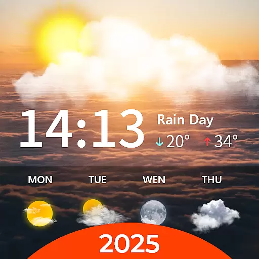
Your Personal Weather Assistant
4.00
Dynamic weather watch face with glass effect, bold time & 7 complications.
4.3
The moon phases app for tracking the lunar calendar, blue moon and full moon.
4.80
Accurate, beautiful weather with landscapes depicting weather, sky, season.
4.50
Weather watch face for Wear OS 5
4.40
Weather watch face for Wear OS 5+
4.10
Hurricane Tracker, Rain Map
4.80
Ultimate weather forecast + moon phase for Wear OS 5+ (Pixel, Galaxy, et al.)
4.70
Check room temperature with this indoor thermometer. thermostat & hydrometer
4.70
Weather channel forecasts weather daily & hourly, local and national air quality
4.70
Powerful US and worldwide earthquake feed with earthquake alerts and maps.
4.60
72-hour weather & daily forecasts with extreme weather alerts
4.60
Track rainfall totals with ease using our rain gauge app. Accurate rain tracker.
4.50
Hyperlocal Forecasts, Live Radar, Severe Weather alerts & Homescreen Widgets
4.30
Live weather radar, widgets & forecasts. Track rain, storms & temperature.
4.20
Detailed weather info and moon phase, subtle animation, customizable
4.0

User Reviews